The author claims the need of a systematic approach “that brings together the design of built environments with the best scientific knowledge of processes of change in complex natural and social systems.” Urban planning must work within these systems that require local info (through participatory practices) and the creation of technical solutions. He thinks the challenge is mapping informality as cities grow in unpredictable ways. He also claims that cities are about connections: “the socioeconomic and physical links that allow each one of us to make a living, obtain services that make our lives easier, and learn and invest our time and resources.”
The effects of connections can be traced as the concentration of social networks in space and time where the value of a group is not proportional to the group’s numbers, but to its interactions. GPS tracking, and smart phone technologies can help track the networks.
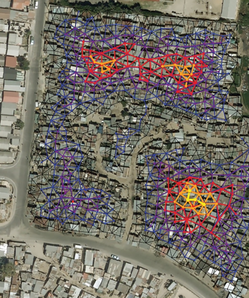
New methods from urban science allow the accelerated evolution of these neighborhoods to follow natural urban processes. They are based in part on the mathematical analysis of detailed maps, including the development of algorithms to optimize building access, delivery of services, formalization of land, and taxation, with minimal disturbance and cost.
Planning through the development of detailed maps at the neighborhood level is also an effective way to capture local, person-centric knowledge, providing a clear vehicle for better local politics via the coordination of priorities and action from communities, local governments, and other stakeholders. The convergence of a networked science of cities, quantitative methods of spatial analysis, and information technology tools is key to allow users to participate.
Full text available here
Luís M. A. Bettencourt (2019) Designing for Complexity: The Challenge to Spatial Design from Sustainable Human Development in Cities Technology|Architecture + Design, 3:1, 24-32, DOI: 10.1080/24751448.2019.1571793